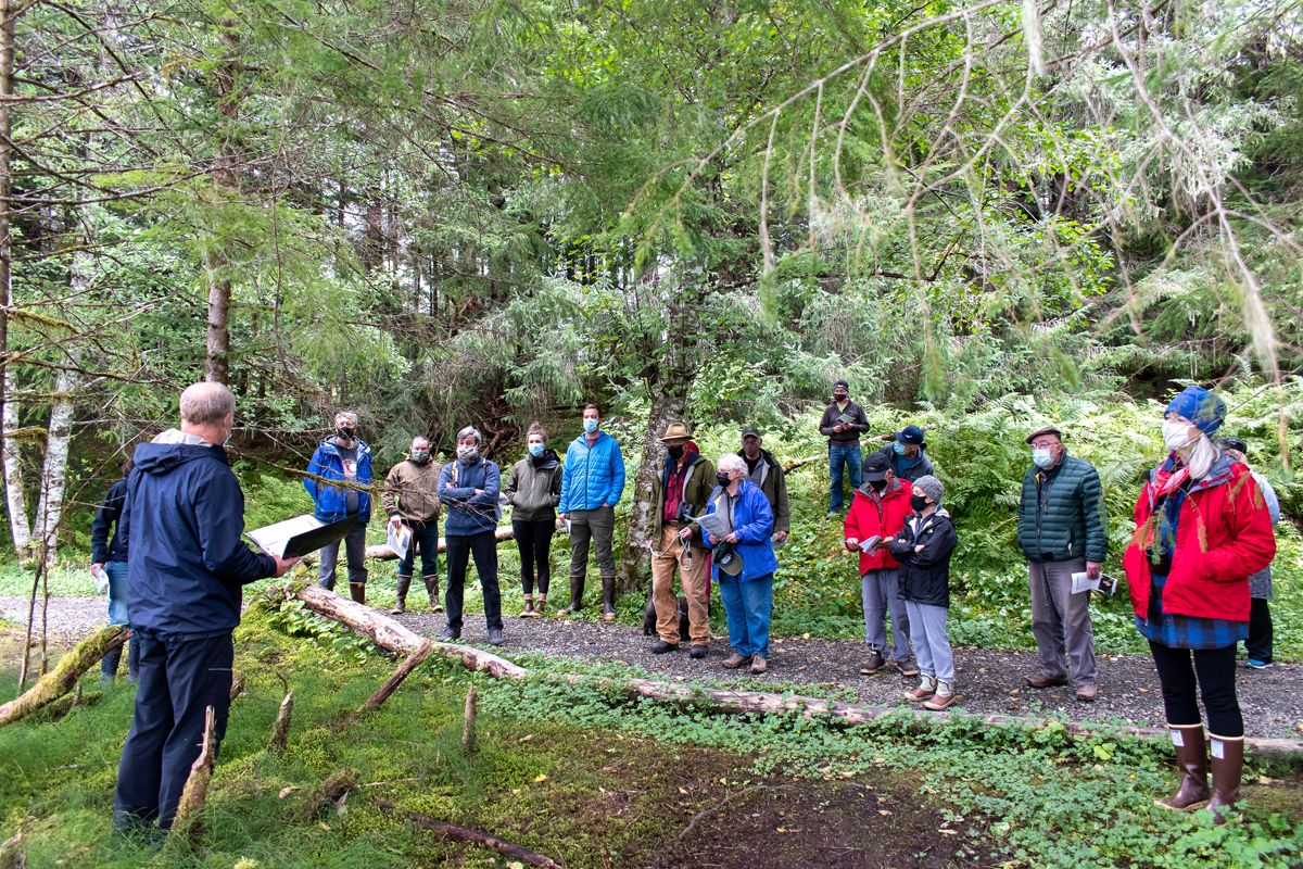
Current Projects
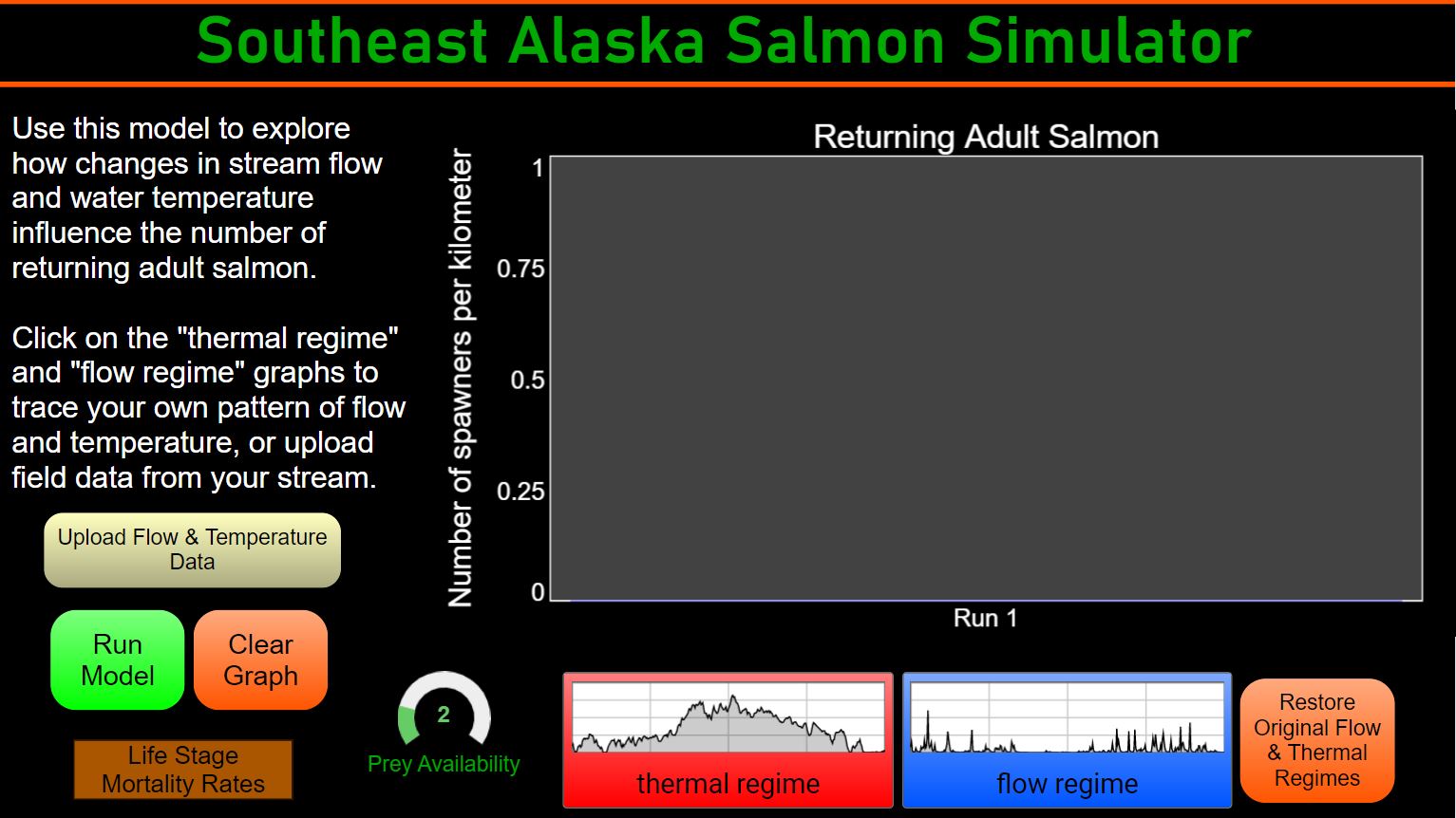
The Salmon Life Cycle Model is live!
Users can use the model to explore how changes in stream flow and water temperature influence the number of returning adult salmon. Currently, the model is set up for pink, chum, and coho. As the simulator is further developed, users will be able to upload their own data and explore other variables.
Check out the simulator here. Contact SAWC’s science director, Rebecca Bellmore at rebecca@sawcak.org for questions regarding the life cycle model.
From the Abstract: Models that assess the vulnerability of freshwater species to shifting environmental conditions do not always account for short-duration extremes, which are increasingly common. Life cycle models for Pacific salmon (Oncorhynchus spp.) generally focus on average conditions that fish experience during each life stage, yet many floods, low flows, and elevated water temperatures only last days to weeks. We developed a process-based life cycle model that links coho salmon (O. kisutch) abundance to daily streamflow and thermal regimes to assess: 1) How does salmon abundance respond to short-duration floods, low flows, and high temperatures in glacier-, snow-, and rain-fed streams? 2) How does the temporal resolution of flow and temperature data influence these responses? Our simulations indicate that short-duration extremes can reduce salmon abundance in some contexts. However, after daily flow and temperature data were aggregated into weekly and monthly averages, the impact of extreme events on populations declined. Our analysis demonstrates that novel modeling frameworks that capture daily variability in flow and temperature are needed to examine impacts of extreme events on Pacific salmon.
To access the full paper, click here.
Klawock Lake Watershed
Keep a blank line with white text.
SAWC is providing capacity for watershed restoration in the Klawock Lake Watershed. On-the-ground projects began in 2021, and will continue in 2022. The tribal work crew started by surveying the watershed and participated in training to get ready to implement restoration prescriptions. This project will also result in a best management practice document at the request of the landowners.
Klawock community members, including native corporation shareholders and tribal members, are the owners and stewards of the Klawock Lake watershed. These Native people have used and stewarded the watershed since time immemorial.
Landowners in the watershed, Klawock Heena Corporation and Shaan Seet, Inc., expressed a desire for information to aid land management decisions. This document, along with the accompanying web mapper, provides land managers with geospatial information about historical resource management, existing infrastructure, and natural resources in the watershed. Importantly, the document also recommends best management practices (BMPs) to consider when planning future land management and development activities, with an emphasis on protecting and restoring salmon habitat, including habitat for sockeye salmon. The information provided in this document and the web mapper is not comprehensive. For more detailed information about past watershed studies and assessments as well as background on watershed resources not covered here, see https://www.alaskawatershedcoalition.org/2020/02/klawock-lake-sockeye-salmon-action-plan/ and other resources provided at alaskawatershedcoalition.org.
Klawock Sockeye Salmon Community Action Plan
Sockeye salmon from Klawock Lake have been important to people for thousands of years. Despite past restoration efforts, it is evident that returns over the last two decades have been significantly less than historically. In 2017, TNC and the Southeast Alaska Fish Habitat Partnership, with support from numerous agency, community, and tribal partners, convened a stakeholder meeting to evaluate the causes and effectiveness of actions to address this decline. The meeting also highlighted the island-wide need for increased community capacity to manage and restore habitat. This has set the stage for the development of a Klawock Sockeye Salmon Community Action Plan – a plan developed with multiple stakeholders and the community to collectively address sockeye salmon declines. SAWC has partnered with TNC, the Klawock Cooperative Association, and numerous organizations agencies, and stakeholders to improve management and habitat of Klawock Sockeye and Pacific Salmon on Prince of Wales Island. We have contracted with Kai Environmental to help us develop the Klawock Sockeye Salmon Community Action Plan.
Keep a blank line with white text.
SAWC partnered with the CBJ Parks and Recreation department to develop a plan for management and development of the Fish Creek Estuary.
Community surveys were used to gain insight on the recreational uses of the area, and research was done to gain information on the indigenous uses of the land. MRV architects assisted with new designs to support the recreational, traditional, and ecological needs of the land.
The area is comprised of municipal and state lands at the junction of Fish Creek and tidelands at the northwest end of Douglas Island. Concepts for improving habitat and recreation infrastructure were developed, discussed, and modified based on extensive public and stakeholder input. This planning document describes existing conditions at the site, concepts for improving the area, and a final plan for improving the Fish Creek Estuary Area.
This plan recommends a light-handed approach to both recreational amenities and habitat restoration, as outlined in the site plan at the end of the document.
The full plan can be viewed here.
Annette Islands Watershed Plan
A changing climate has recently highlighted changes and vulnerabilities in salmon habitat and streams. We will work with the Metlakatla Indian Community – Department of Fish and Wildlife to create a watershed restoration plan for Annette Island. Planning is build on a site visit from 2019. Field crews worked on the ground in the summer of 2022 collecting baseline data to be used in the planning process.
An output from this project will include creating a watershed advisory council to recognize and prioritize restoration needs on Annette Island. If you’re a Metlakatla local and interested in being a part of this group, please contact kelsey@sawcak.org for more information.
Check out the latest update on the plan here.
Jordan Creek Stormwater Monitoring and Management

Keep a blank line with white text.
Lower Jordan Creek is highly urbanized, and the stream habitat and water quality suffer from loss of riparian vegetation and sediment and pollutants in stormwater runoff. With funding through the AK Department of Environmental Quality, SAWC is monitoring water quality in lower Jordan Creek to understand the impacts of stormwater, and will be teaming up with Super 8 on a riparian enhancement project. In the coming year, we will begin work with stakeholders on a comprehensive, solutions-based watershed management plan for Jordan Creek.
Margaret Creek Restoration
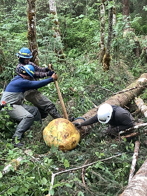
Intensive timber harvest in the 1970s damaged floodplain, riparian, and stream habitat in the Upper Margaret Creek watershed. This project will restore fish habitat and other natural channel functions by placing large woody debris in the channel using hand tools and heavy machinery. Riparian forest will be thinned to enhance recovery of old-growth conditions.
This project combines the power of heavy machinery and human muscle to restore this remote location. A crew from the Ketchikan Indian Community was on site in July of 2022 working to add large wood into the stream to help create fish habitat. Heavy machinery work was completed in August of 2022, with plans to continue hand tool restoration in 2023.
Check out the latest update!
Keep a blank line with white text.
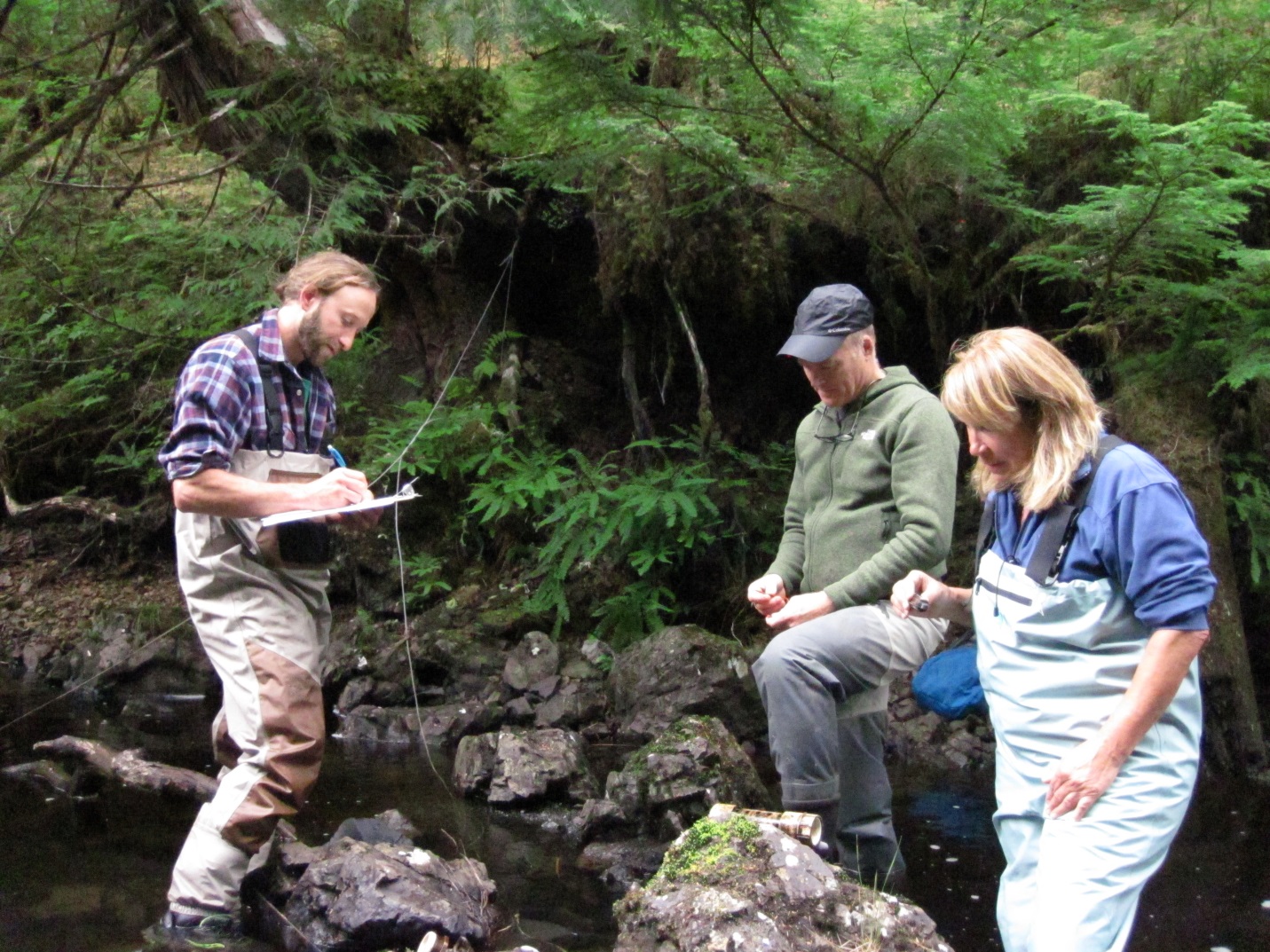
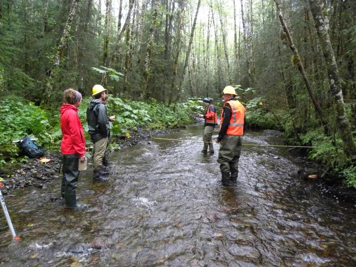
SAWC is helping to coordinate a regional, community-based stream temperature monitoring network. Tribes, watershed councils, the University of Alaska, and government agencies are all monitoring different sites across the region. Stream temperature is being measured hourly year-round at over 50 sites around Southeast Alaska. Data will be useful for tracking change over time and understanding how our valuable aquatic resources may respond to climate change. Check out the project page for more information on existing monitoring sites, methods for collecting and sharing data, and how to get involved.
Restoration Opportunities on Admiralty Island
Keep a blank line with white text.
Keep a blank line with white text.
SAWC is partnering with the US Forest Service to conduct a site condition and restoration opportunity assessment of Admiralty Island’s Florence Lake and Ward Creek watersheds. These remote watersheds were heavily logged and roaded in the 1980’s and 90’s while in private ownership. The US Forest Services has now purchased this land, which will become part of Admiralty Island National Monument. Remote, rugged, and challenging to access, SAWC is helping with the effort to assess and restore these lands by bringing in technical expertise and evaluating if SAWC’s in-lieu fee mitigation program can be used to support wetland and stream restoration.
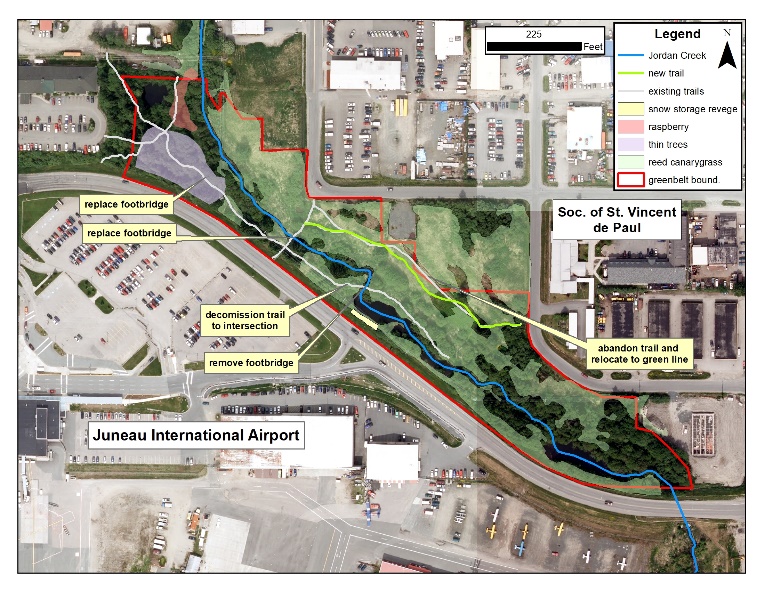
Jordan Creek Greenbelt
Habitat for Fish and People
Keep a blank line with white text.
Keep a blank line with white text.
We are teaming up with the Juneau International Airport, Discovery Southeast, Society of St. Vincent DePaul, and Trout Unlimited to improve bridges and trails, remove litter, fight invasive species, restore riparian habitat and teach youth about natural history in Juneau’s Jordan Creek Greenbelt area. Located at the south end of Jordan Ave, the Greenbelt is a natural gem in a densely urbanized area, and some TLC will provide both social and ecological benefits. Funding provided by the National Fish and Wildlife Foundation’s 5-star Urban Waters Program.
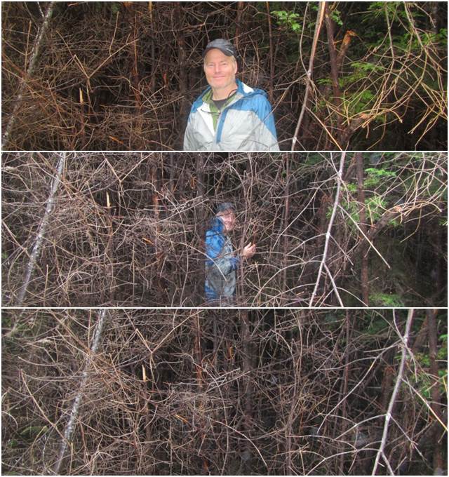
Knot in Juneau’s Backyard
Keep a blank line with white text.
SAWC is joining forces with the Alaska Department of Transportation to battle invasive Bohemian knotweed in Juneau in 2019. One of the most invasive non-native plant species found in Alaska, knotweed is found throughout Juneau where it outcompetes and displaces native plant communities that provide natural beauty, berry harvesting opportunities, and habitat for fish and wildlife. With financial support from the Copper River Watershed Project’s invasive plant mini-grant program, SAWC staff will work with ADOT maintenance crews to eradicate 60 knotweed infestations growing in road rights-of-way starting in July.
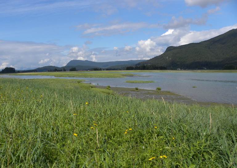
Mendenhall Wetlands
Keep a blank line with white text.
The Mendenhall Wetlands provide unique habitat for many types of fish, plants, and invertebrates, and have been recognized as a globally important bird area. Locally, the wetlands are an important recreation, hunting, fishing, and wildlife viewing area. For many decades, Juneau’s development and urban activities have been encroaching on this critical habitat, and five streams that are considered “impaired” by various types of urban pollution drain into the wetlands. SAWC is initiating an effort to explore potential restoration opportunities in and adjacent to the wetlands to improve habitat for fish and wildlife, and we are currently focusing on improving water quality in Jordan Creek, a major urban tributary to the wetlands, to reduce the amount of urban pollution entering the wetlands.
Helping Fish Reach Habitat
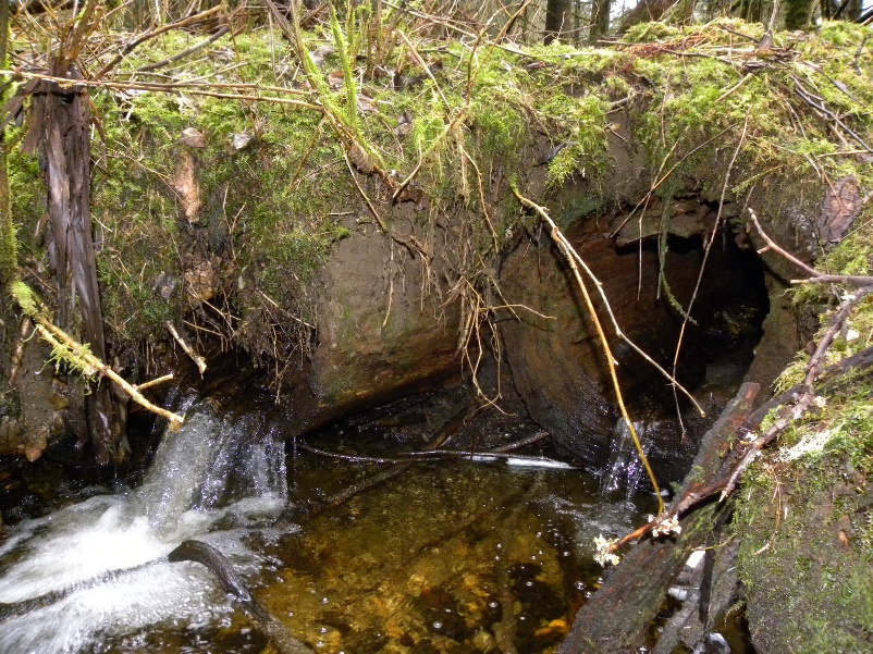
Keep a blank line with white text.
Trees that fall into streams create excellent habitat for salmon and other fish, and placing trees into stream channels is a common habitat restoration technique where streamside logging has occurred. In Juneau’s Switzer Creek watershed, SAWC is actually removing large trees from a small stream to help salmon. This spring our contractor will remove three hollow tree trunks from a small stream near the end of Mountain Ave. The hollow trees functioned as culverts by passing the stream under a former logging road. Now highly decomposed and blocking the upstream passage of fish, the hollow logs will be replaced with stream channel spanned by a new footbridge. The project is supported by the US Fish and Wildlife Service and Patagonia, Inc.
Are you interested in staying in the loop on any of these projects? Send an email to khrystl@sawack.org to be added to our mailing list!
Or, sign up to receive our quarterly SAWC newsletter!
Web Mapping Products
SAWC is working to create a variety of web mapping products in ArcGIS Online. Some products help us elevate the voices of restoration through story mapping, while others help us provide spatial data to our partners.
This interactive application is designed to support the goal of community participation in Juneau. Each point on this map is a location of past or future restoration activities. Nearly 40 different waterbodies within the Juneau area are organized into different tabs, and selecting a waterbody will highlight their associated projects. The user can zoom in on the map to look closer at different areas – and see what may be happening in the neighborhood. Clicking on the different points will open up more information about a particular project.
A collaboration between SEAKFHP, SEALT, and USFWS, WESPAK-SE 2.0, aka the Wetland Ecosystem Services Protocol for Southeast Alaska, is a web-mapping application to assist in the completion of the WESPAK office form.
Restoring Salmon Watersheds on Tribal Homelands Story Map
This story map was created to support SAWC’s 2022 America the Beautiful grant proposal and shows a variety of projects we hope to complete around Southeast Alaska. All of the projects highlighted are high on SAWC’s priority list for more assessment work and to continue restoration work that has already begun.
In 2014, the U.S. Forest Service, U.S. Fish and Wildlife Service and Southeast Alaska Watershed Coalition (SAWC) teamed up to remove a fish ladder and undersized culvert at the mouth of Juneau’s Picnic Creek. The project improved access to about a mile of stream habitat for pink salmon and other species. In 2018, work continued that resulted in removing a fish ladder that was impeding fish passage. With the ladder gone, fish returned to the stream in 2021. Check out the story map for more information on this success!
In 2021, CBJ asked SAWC to produce a map to facilitate discussion for improvements being made to the Montana Creek Area in Juneau. The interactive mapper is designed to give the public a more complete picture of the environment within the Montana Creek Planning area. It was created by the Southeast Alaska Watershed Coalition and uses a variety of publicly available data layers from CBJ, ADF&G, the Forest Service, and more.
This online web-mapping application was created for the landowners of Klawock. The application allows the user to view areas of interest and overlay related data, like anadramous water information, ownership, geologic layers, and more!
Watershed Restoration Prioitization Mapper – In Progress
A work in progress, this mapper contains information on watershed and other assessments and on-the-ground projects across Southeast Alaska. It also contains a variety of layers to help inform the user of current environmental conditions in the region. Comments are accepted! Please email khrystl@sawcak.org for more information or to give feedback on this projcet.
Past Projects
Keep a blank line with white text.
Past logging activities have degraded fish habitat in some sections of Pat’s Creek, near Wrangell, AK. During summer 2019, spruce trees will be strategically added to a reach of stream to improve salmon habitat, and an abandoned logging road will be breached to allow East Fork Pat’s Creek to migrate naturally across its floodplain. Funding and project partners include the US Fish and Wildlife Service, Alaska Department of Natural Resources, Alaska Sustainable Salmon Fund, the National Fish and Wildlife Foundation, and the Charlotte Martin Foundation.

Keep a blank line of white text.
Keep a blank line of white text.
The goal of this assessment was to compile a dataset and report outlining key aquatic resources within the City and Borough of Wrangell, including as assessment of the current habitat conditions, identification of sites that could benefit from restoration and treatment, and outlining watershed management challenges and opportunities. The project was carried out with support from teh US Fish and Wildlife Service, Wrangell Cooperative Association, US Forest Service, and Charlotte Martin Foundation. The full report is now available online!
Picnic Creek Fish Passage
Keep a blank line with white text.
Keep a blank line with white text.
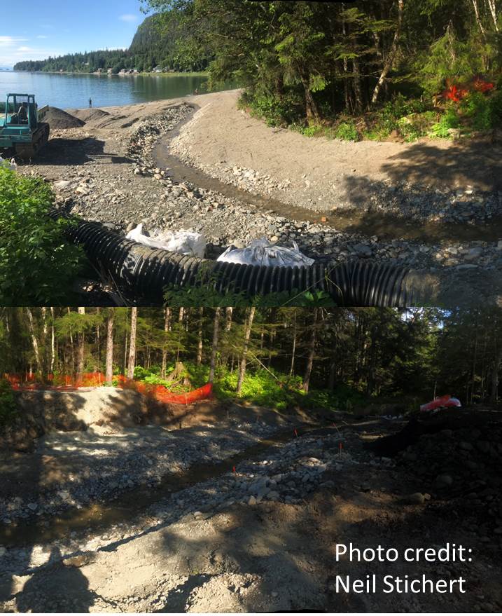
Formerly the site of a deteriorating concrete fish ladder, the outlet of Juneau’s Picnic Creek at the Lena Point recreation site presented several barriers to safe passage from ocean to stream to the stream’s pink salmon population . With support from the US Fish and Wildlife Service and the US Forest Service as a project partner, SAWC contracted engineering firm Interfluve, Inc. to design a roughened channel stream as a replacement to the weathered fish ladder. The US Forest Service, with the help of Glacier State Construction and Sealaska, completed the restoration work and SAWC fixed a perched culvert a the crossing of Lena Cove Rd. Construction of the project was completed in 2018, allowing for full passage of fish species accessing the stream.
Recent blog posts
- Our post-2023 field season newsletter is here! October 20, 2023
- Job Alert: Regional Invasive Plant Coordinator March 20, 2023
- Calling all artists! December 5, 2022
- *NEW* Alaska Invasives ID App May 2, 2022
- Salt and Soil Moves to Ecotrust May 2, 2022
- It may look good from afar, but it’s far from good. May 7, 2021
- Annual Spring Clean Up May 1st, 2021 April 19, 2021
- SAWC Presents: Making Watershed Plans Work March 10, 2021